

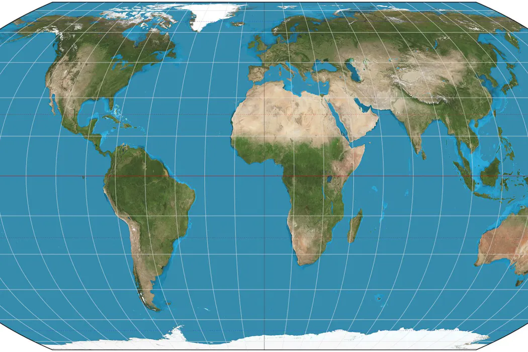
The United Nations adopts an equal-area world map, drawing renewed attention to how geographic projections influence perceptions of continents’ size and scale. The change is linked to longstanding mapping conventions that have shaped how the world is seen for centuries.
Across the reporting, the focus is not only on the UN’s decision but also on earlier scholarly disputes about how Earth was charted. Both sources point to the dominant role of a 1569 chart associated with Flemish geographer Gerardus Mercator and note that other geographers challenged aspects of how the globe was represented. The pieces discuss three geographers whose disagreements over historical charting continue to resonate in modern map-making, especially when depiction affects how people interpret relative geographic importance.
While the articles share the same core framing about an equal world map and the legacy of past cartography, one outlet emphasizes the broader historical and educational angle by centering the story around the contested origins of mapping conventions.