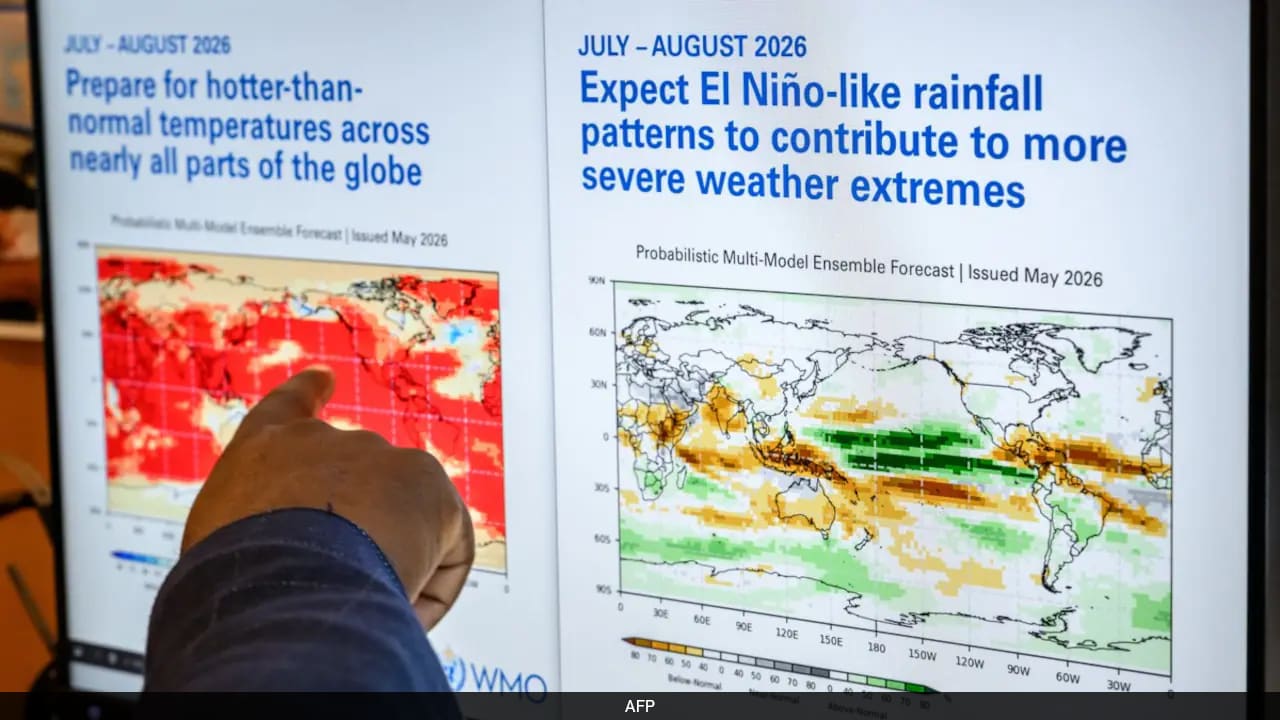
The United Nations’ weather and climate agency warns that El Niño is already developing and is likely to strengthen rapidly into a “strong” event between July and September. The World Meteorological Organization (WMO) says current conditions in the tropical Pacific indicate increasing confidence that strong El Niño is taking shape. WMO forecasts cited across reports point to continued strengthening through the Northern Hemisphere autumn, with the effects expected to influence weather and climate patterns in many regions beyond that period.
El Niño is described as a natural climate phenomenon marked by warmer surface temperatures in the central and eastern equatorial Pacific, which shifts global winds, pressure and rainfall patterns. WMO classifies events by intensity levels and states this one is expected to reach the third-highest level out of four.
The agency warns of elevated risks associated with strong El Niño, including drought and heavy rainfall, heatwaves on land, and marine heatwaves. It also notes that forecasts point to above-average temperatures across much of the inhabited land outside polar regions, and that July–September rainfall patterns are consistent with a strengthening El Niño, including above-normal rainfall in parts of the southwestern United States and below-normal rainfall across areas such as the Indian subcontinent and much of Australia. WMO also says there is no evidence that climate change increases El Niño frequency or intensity, though it can amplify associated impacts.