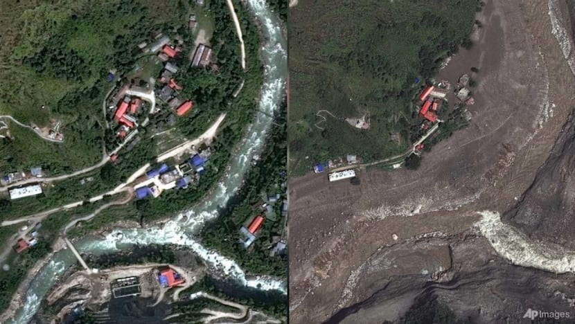
Catastrophic flooding along the Nepal–China border prompts an investigation into its cause after satellite images suggest a bedrock and glacier collapse upstream. Earth scientists and rescue teams review before-and-after satellite views to understand how the collapse occurs and how debris and meltwater move into river channels.
According to reports from multiple outlets, the imagery is used to identify where people were living near affected areas and to map the extent of devastation, including debris that buries villages. Scientists also look for indications of the collapse and its timing, while authorities continue rescue operations and search for missing people. The different coverage focuses on how satellite data can reveal both the physical source of flooding and the downstream impacts on settlements.
Overall, the outlets describe a coordinated effort to combine emergency response with remote sensing evidence, aiming to connect the initial geologic and glacial event to subsequent river flooding and damage along the border region.