


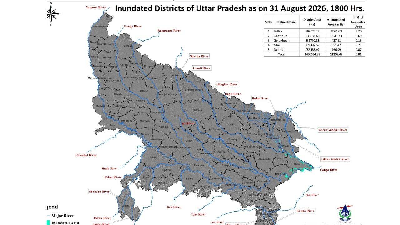
Rising river waters inundate more than 11,000 hectares of land across five districts in Uttar Pradesh, according to reporting from The Times of India. The flooding affects agricultural and other low-lying areas as water levels continue to rise.
The coverage notes the spread of inundation across multiple districts rather than a single locality, highlighting the scale of the impact. While outlets agree on the broad figures and the districts involved, they do not present the same level of detail on specific causes of the rise, the exact river names, or the administrative steps being taken in each affected district. Differences also appear in how extensively sources describe on-the-ground consequences such as crop losses versus general land area figures.
Overall, the reports portray a coordinated multi-district flood situation driven by elevated river levels, with the primary shared data point being the total area submerged and the geographic spread across five districts in Uttar Pradesh.


