


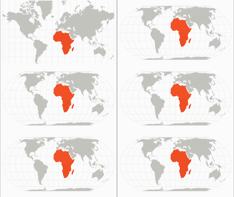
The United Nations adopts a new world map projecting different relative sizes of land areas, with Australia and Africa appearing larger while North America and Europe appear smaller. The change centers on moving away from a widely used traditional projection associated with the Mercator map toward the Equal Earth projection.
Across the outlets, a key point is that the US opposes the decision. The US is described as the only country to vote against the move to limit the use of the famous 16th-century Mercator map for the Equal Earth projection. The US position is reported as arguing that the approach promotes an “ideological agenda.” The other reporting outlets present the adoption as a UN-level step affecting how world geography is visually represented in official materials.
While all sources align on the outcome and the US dissent, they reflect different emphasis typical of their coverage: each highlights the same geographic effect of the new projection and the same vote against it, without adding differing substantive claims about alternative motivations or technical details.

