


NASA’s NISAR satellite has captured a distinctive “hummingbird”-like pattern hidden beneath Antarctica’s ice, according to reports. The radar images show how features in the landscape below influence the slow movement of glacier ice. One explanation highlighted across coverage is that a mountain or underlying structure interrupts ice flow, creating a pattern that becomes visible in the radar measurements. Using advanced radar technology, the mission maps details that are not easily seen from the surface, including indications of cracking and shifting ice-related structures tied to the underlying terrain. The images also illustrate how polarised microwave signals interact with the ice, with different colours reflecting variations in how the signals reflect and scatter through the region. The observation is presented as evidence of how glaciers respond to what lies beneath them. NISAR is described as a joint effort involving NASA and ISRO, using sophisticated radar instruments to study Earth’s surface and subsurface processes.
NASA’s NISAR captures “hummingbird” pattern beneath Antarctica’s ice
NASA’s NISAR satellite has captured a distinctive “hummingbird”-like pattern hidden beneath Antarctica’s ice, according to reports. The radar images show how features in the landscape below influence...
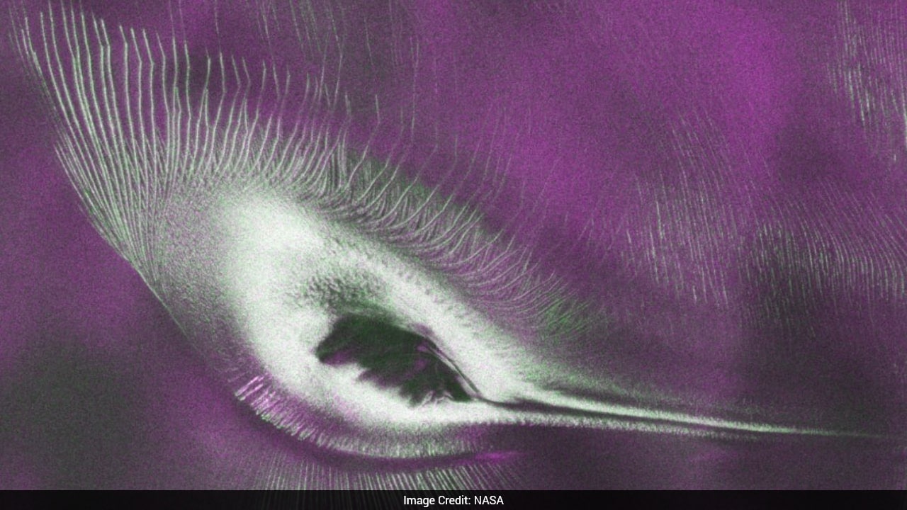
- NASA’s NISAR satellite images reveal a “hummingbird”-like pattern beneath Antarctica’s ice.
- The pattern is linked to ice flow being affected by underlying terrain, including a mountain interrupting glacier movement.
- Radar observations detect hidden structures such as cracks and shifting patterns under the ice.
- Different colours in the imagery reflect how polarised microwave signals interact with and reflect from the ice.
- NISAR is a joint NASA–ISRO mission using advanced radar technology.
The colours in the image show differences in the way polarised microwave signals interact with and reflect from the ice.
4 hours agoNasa's NISAR satellite captured Antarctica's unique hummingbird ice formation. This striking pattern resulted from a mountain interrupting the slow movement of glacier ice. Advanced radar technology mapped hidden details within the icy terrain, revealing cracks and shifting patterns. The image shows how Antarctica's glaciers respond to the landscape beneath them. This joint mission between Nasa and Isro uses sophisticated radar systems.
17 hours ago
Iran targets Bahrain and Kuwait after U.S. strikes over Strait of Hormuz tanker attacks
Air raid sirens sound in Bahrain and Kuwait as Iran’s Revolutionary Guards carry out attacks on U.S. military-related si...

Xryma Plc outlines planned Euronext Paris reapplication and liquidity facility
Xryma Plc says it intends to reapply within the next 12 months for admission to list on Euronext Paris (Euronext), subje...

Niutech announces titanium-iron tailings reduction and enrichment technology
Niutech, described by PR Newswire as a global leader in industrial continuous pyrolysis technology, announces its “new-g...